Last updated: Jun 23, 2025
Discover one of the most remote and spectacular multi-day treks in Georgia, the Omalo to Shatili trekking route, connecting the regions of Tusheti and Khevsureti via the dramatic Atsunta Pass (3431 m). A 75 km long trail will take you through the East Caucasus range, where you will visit remarkable medieval fortresses and ancient villages. Tusheti becomes isolated and covered with snow from October to June, making it impossible to access via spectacular Abano pass 2950 m (also known as one of the most dangerous roads in the world according to BBC) and thus limiting the precious hiking period. On the other hand, though, it gave these regions the possibility to keep local traditions and architectural styles.
So in this article you will find a detailed description of the Omalo-Shatili hiking trail that was done in September 2020. The sunny and perfect weather allowed us to cover the whole trail successfully in 4 days. Due to the ongoing Coronavirus pandemic in the world plus the end of the season, we were literally alone on this trek, but usually it’s one of the most popular Georgia hikes. You can read more about other hiking trails or what to see in Georgia in our blog. So let’s begin:
Want to skip the planning and go with full support, gear transfers, and real local connections? Join our Omalo to Shatili Trekking Tour, a fully-organized adventure across one of the most legendary hiking trails in Georgia.
Important facts to know before you start Omalo – Shatili trail
Total length of trail: 75 km.
Start point: Upper Omalo, Tusheti region.
End point: Shatili, Khevsureti region.
Duration: 4 days, but some people do in 5 days too.
Difficulty: Moderate/hard
What should you pack?
Hiking boots, gear, camping equipment and cash.
When should you go?
June – September (depending on the road and snow conditions that year).
What are the dangers?
Aggressive shepherd dogs, high altitude pass, altitude sickness, fast change in weather, remoteness, language barriers, if you feel unsure or it’s your first hiking experience, better to join guided hikes.
What are the highlights?
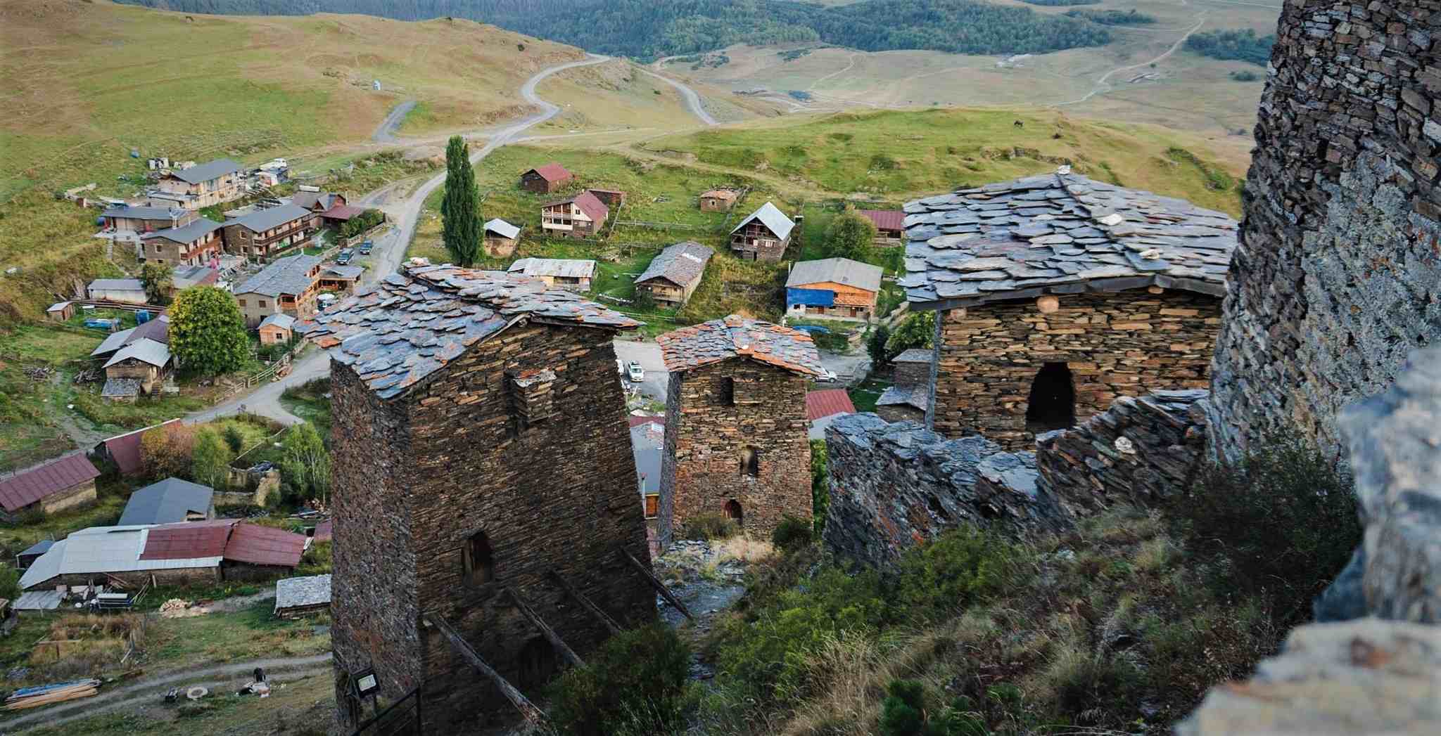
Tusheti and Pshav-Khevsureti National Parks, endemic wildlife, the hospitality and food of local communities, high mountain passes, regional history and traditions, medieval defence towers.
Where to stay?
There are guesthouses in Omalo, Dartlo, Parsma, Girevi and Shatili, see the list of recommended guesthouses at the end of the article. Although 2 nights you have to stay in tents.
How to get to the start?
Take Marshrutka from Ortachala bus station in Tbilisi to Upper Alvani (Zemo Alvani) and there hire a driver to Omalo.
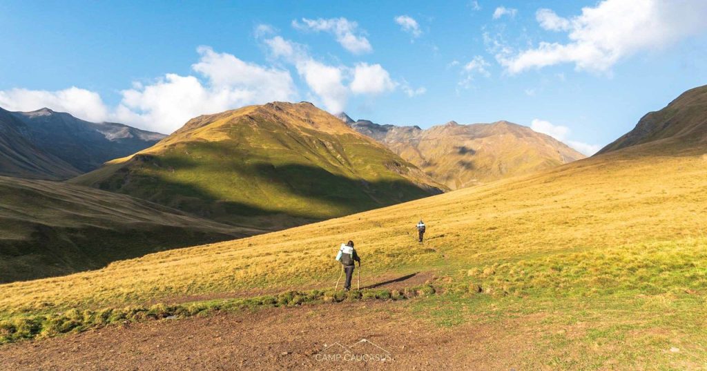
Day 1 Omalo – Parsma
Distance: 25 km
Accumulated elevation gain: ⬆ 1152m; ⬇ 969 m
Hiking time: 10 hours
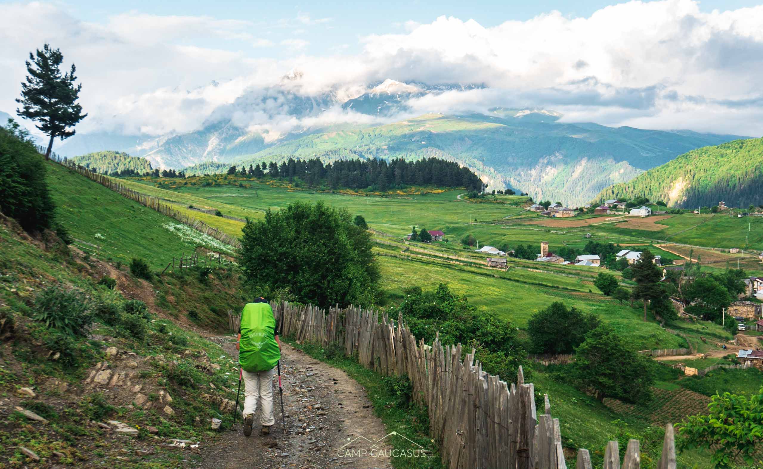
The trail starts from Upper Omalo (zemo Omalo), so if you’ve arrived in Lower Omalo (kvemo Omalo), first you need to go up there, then pass Keselo fortress and continue walking to the right on the dirt road. You will descend through the forest trail to a small valley with a signpost that says to turn left, but it’s for the cars. You need to go to the right and soon start following the footpath to the left that will take you through the forests and eventually will connect to the dirt road. You will start losing the height, so don’t expect a lot of open views. At 11th km, you will reach the river, cross the bridge and arrive in a beautiful village named Dartlo.
Some people do like to stay and spend a nice evening in Dartlo (also explore nearby village Dano) and hike the rest of the trek the next day, if you have time we’d advise to split it too. Though we preferred to cover a bigger distance at once. From Dartlo, you continue again on the dirt road but in the valley, so you will have a sight of stunning mountains. In some 2 hours, you will pass by the village Chesho from which will be left only 6 km till Parsma, the endpoint of the first hiking day.
Other option:
If you wish, you can continue hiking till the next village Girevi, which is 4 more km.
Day 2 Parsma – Kvakhidi meadows
Distance: 17 km
Accumulated elevation gain: ⬆ 735 m; ⬇ 385 m
Hiking time: 7 hours
Continue walking on the dirt road (a small part of it was under construction) towards village Girevi, it’s easy 4 km. When you come near the village go to the left to the riverbank, where you will need to show passports at the border checkpoint, though it won’t take too long. Girevi is the last inhabited village in the Pirikita Alazani valley, so after passport check you start walking on the footpath. First, you go up on the tower hill, there are signposts too. The trail is easy to follow with mild altitude changes, you will pass ruins of village Chontio and several shepherd shelters.

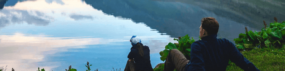
In the last 4 km you get to walk on the riverbank, a bit of rock climbing but no need to cross the river. You’ll go up on the hills again and gain more height and finally, you will see the flat field – Kvakhidi meadows (2400 m) with several shelter-like buildings on the other side of the river. That’s a nice camping place, although sometimes it might be too crowded. Cross the iron bridge and choose the spot for a night.
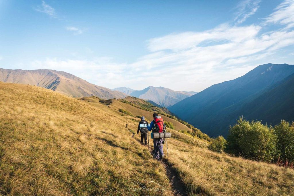
Day 3 Kvakhidi meadows – Khidotani ridge
Distance: 16 km
Accumulated elevation gain: ⬆ 1194 m; ⬇ 1120 m
Hiking time: 10 hours
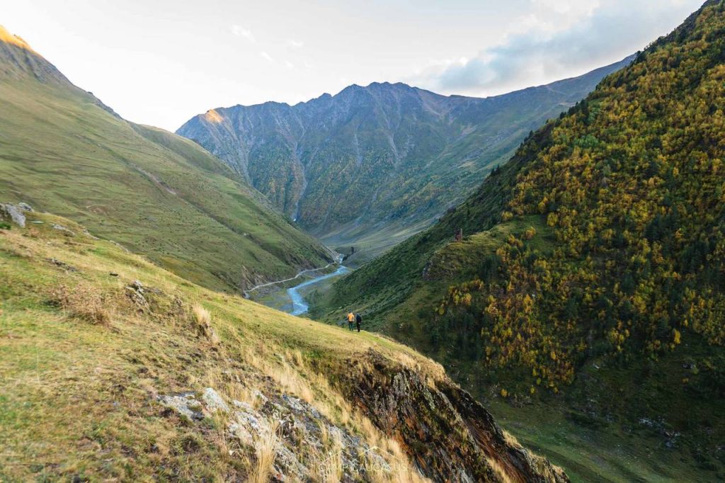
Try to start the day early in the morning, as this is the most demanding and rewarding part of the Omalo to Shatili trekking route, as you climb over Atsunta Pass, one of the highest and wildest points on any marked hiking trail in Georgia. Cross back the iron bridge and continue walking on the trail to the left on the right side of the river. This way you will skip crossing the rivers two times. You can lose the trek here and there, but it will appear again, just walk until you will meet the trail from the other side of the river. From here you have astonishing views and it will be better and better, if the weather allows.
After 5 km, you will see the rock with writing “exit Shatili”, that’s where you cross the river to the left and you start ascending to the valleys, here the pace drops down to almost 1 km per hour, exhausting but totally worth it.
Later on, you will cross one last stream (it was dried out) and you’ll start zigzagging on shale stones that will take you to Atsunta pass eventually. It’s wearying but the trail is well-trodden and visible, sometimes it’s even like stairs. However, be careful because in fog or rain it can be quite slippery and dangerous.
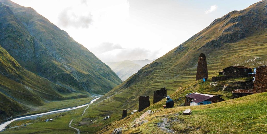
From the pass, you will be zigzagging down the slope again. And at some point, you will turn to the left from where will start light ascend to the picturesque Khidotani ridge. Here you’ll have fantastic panoramic views of high mountains, and it’s possible to camp although keep in mind that it’s a very windy place. Or you can continue hiking 2 more km till border guards and camp there. There’s a cafe, which wasn’t functioning.
Day 4 Khidotani border checkpoint – Shatili
Distance: 18 km
Accumulated elevation gain: ⬆ 692 m; ⬇ 1784 m
Hiking time: 7 hours
The morning will continue with beautiful views on the trail but soon you will start a steep descend through the forest. Zigzags will take you down to the river at Khonichala valley from where you will continue walking to the left and river flowing from the right. Soon you will cross the river and then back again, but don’t follow the road that goes up on the left, walk on the trail next to the river, or you’ll make an unnecessary circle that will connect back to the trail. You will cross one more wooden bridge and meet the last border checkpoint before Mutso.
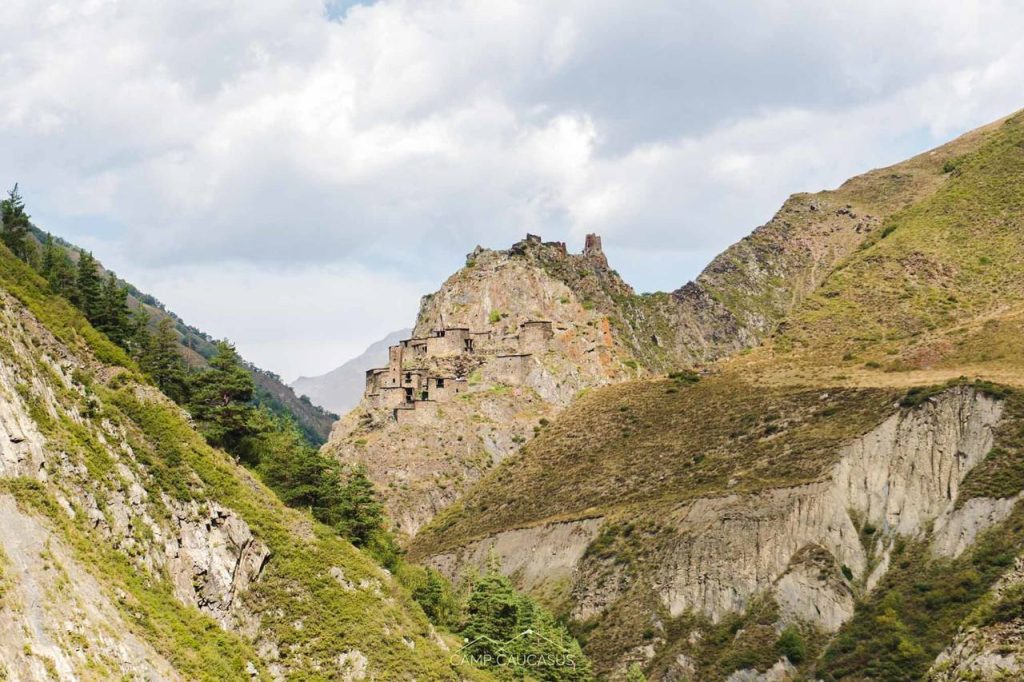
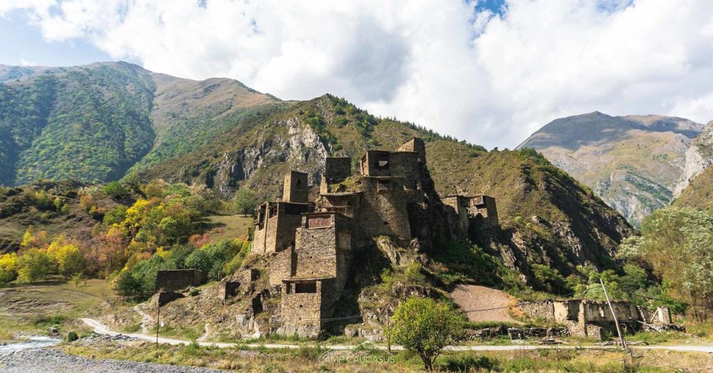
In Mutso, you can walk up to the medieval fortress. Last 13 km you follow a dirt road along the river. 4 km before Shatili you’ll pass Anatori Necropolis, also recommended to visit it. After half an hour you’ll be in Shatili (1400 m). It is a unique medieval fortress-settlement with around 60 defence towers, that form a single chain of fortifications. It’s in a tentative list of UNESCO World Heritage site.
How to leave Shatili
Marshrutkas from Shatili go to Tbilisi every Thursday and Sunday at 12:00, costs 20 Gel. Ride will take around 5 hours via the impressive Datvisjvari Pass (2690 m).
Where to stay in Tusheti
Lower Omalo – Hostel Tishe + shop Upper Omalo – Guesthouse Shina Dartlo – Guesthouse Samtsikhe + restaurant Parsma – Guesthouse BasoGirevi – Shio’s Guesthouse
Where to stay in Shatili, Khevsureti
Shatili – Guesthouse Mziani
Recommendations:
- Water is everywhere, in villages, or as streams and springs, so no need to carry a lot.
- There are a lot of Shepherd dogs, very defensive of their sheeps, be very careful and try to avoid herds as much as possible, and stay closer with your group.
- Don’t forget to bring your passport, as the trail goes near Russian border, you will need to register at several border checkpoints.
- The most of the trail is marked with yellow signposts and painted flags on rocks and trees, but we still recommend to have downloaded gpx track on your phones. And also extra batteries for it.
- Be respectful and don’t cross fences for shrines and holy places, it’s strictly prohibited for women to enter them. Also don’t bring pork to Tusheti, Tush people believe it brings misfortune.
- Be prepared that most of the trail, you won’t have phone connection, except for Omalo, Dartlo and Shatili.
- Keep in mind that due to heavy rainfalls or landslides the road might be closed for some period in summer too, so pay attention to road conditions. Also feel free to get inspired through our blog for other traveling options and Georgia hikes or just avoid a planning hustle and join our small group adventures.
Looking to experience this incredible trail with peace of mind and no logistics stress?
Join our Omalo to Shatili Trekking Tour
Recent Articles
-
Self-guided Walking Tours – Everything You Need to Know
Self-guided walking tours weren’t a common solution to use for travelers till Covid-19 came into the game. But it wasn’t something new…
-

How to Travel to Mestia from Tbilisi, Kutaisi or Zugdidi in 2026
The detailed guide on how to get to Mestia from Tbilisi, Kutaisi, Zugdidi, or Batumi by Marshrutka, train, or plain. Plan trip to Svaneti!
-
Tusheti National Park
Tusheti National Park is a huge National reserve on the East Caucasus Mountains. It is located in the structural basin of Tusheti,…


