Last updated: Sep 23, 2020
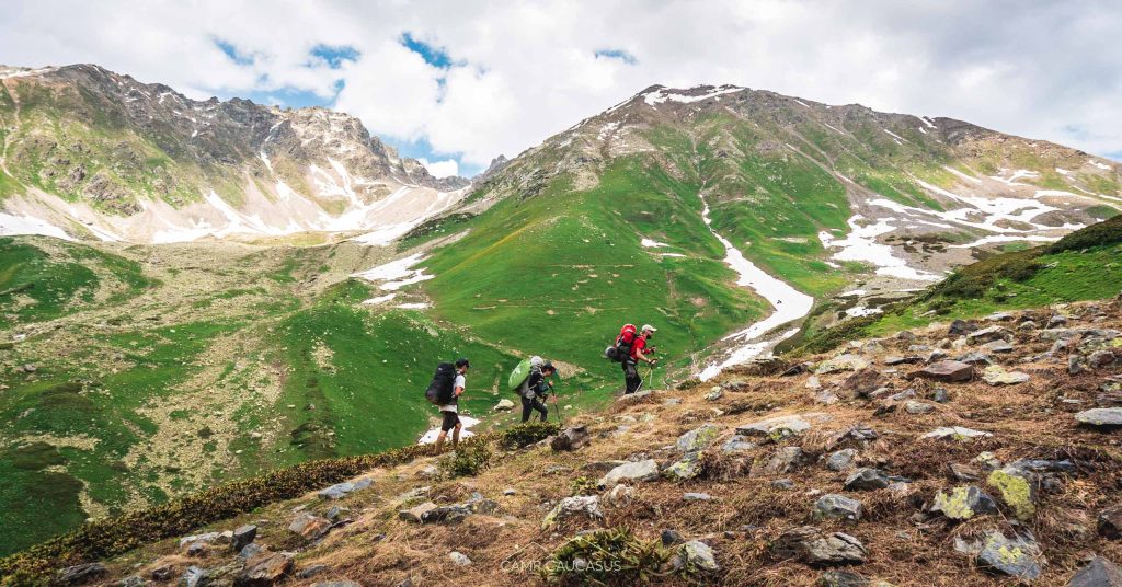
There are various very interesting hiking trails in Georgia (country), but the longest hike would be the Transcaucasian trail. A 10-day hike in the wilderness between the oldest villages in Svaneti region including the highest inhabited village in Europe – Ushguli. It takes you through the five spectacular passes, making the landscape change fast. Deep, forested valleys or rushing rivers and alpine meadows alongside the powerful peaks and stunning glaciers of the Greater Caucasus is all worth it to challenge yourself and take this adventure.
We hiked TCT and a bit more in June of 2020, right after COVID-19 lockdown ended in Georgia. So basically we were the first hikers and tourists in season, whole nature to ourselves but also a bit sad to see such empty resorts. In normal conditions, there are 200 hikers daily walking the last Mestia – Ushguli part of the trail, making it well trodden and better marked, but knowing the trail in advance and having gpx track is still highly recommended. If you’d like to avoid planning hustle, you always have an option to join our guided adventures as well.
Important facts to know before you start TCT
The trail is divided into five sections: 1 Chuberi to Nakra, 2 Nakra to Becho, 3 Becho to Mestia, 4 Mestia to Adishi and finally, 5 Adishi to Ushguli. To learn more about them continue reading further, but first some facts about TCT:
Total length of trail: 150 km
Start point: Chuberi community, village Kvemo Marghi (840 m)
End point: Ushguli (2200 m)
Duration: For full distance 10 days, but you can make it shorter by taking any specific section according to your preferences.
What should you pack?
Hiking boots, gear and camping equipment (if camping) and cash.
When should you go?
May – October (depending on the section and level of snow that year).
What are the dangers?
High altitude passes, fast change in weather, remoteness, language barriers, shepherd dogs, if you feel unsure or it’s your first hiking experience, you can join guided hikes.
What are the highlights?
National park, endemic wildlife, the hospitality and food of local communities, high mountain passes, regional history and traditions.
Where to stay?
There are guesthouses in every village, see the list at the end of the article.
How to get to the start?
Train to Zugdidi and then Marshrutka/taxi to Kvemo Marghi.
Highlights of TCT in Svaneti by sections
Section 1: Chuberi to Nakra
Distance: 27 km
Accumulated elevation gain: ⬆ 2296m; ⬇1861m
Hiking time: 10 hours
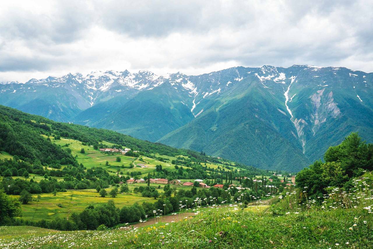
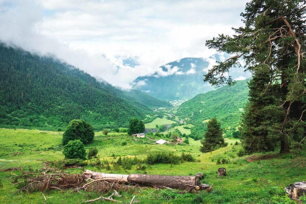
In Chuberi community, village Kvemo Marghi (844m) is 80 kilometers from Zugdidi, nestled in the Nenskra Valley. It’s the starting point of our exciting hike. It starts with a dirt road, until you eventually come to a wooden bridge or one might say – a fallen over tree. From here, the hike really begins. You will ascend more than 2 km vertically on this day.
The western part of Svaneti feels different from the much more visited eastern part. It doesn’t have the ancient ruins and towers, but makes up for it with spectacular raw natural beauty. On the way, you will see a beautiful alpine lake, panoramic views at astonishing Utviri pass (2,720m), and pristine nature. Its flourishing with alpine meadows connects the Nenskra valley to Nakra.
Recommendation:
- Utviri pass took us about 5 hr to cross it. Trail is not challenging, but you need to keep in mind constant climbing up, and possibilities of bad weather. We would advise you to start the hike in the very early morning to manage it till Nakra on the same day or do it in 2 days and camp next to the lake, sunrise would be magical there.
Section 2: Nakra to Becho – Mazeri
Distance: 35 km
Accumulated elevation Gain: ⬆ 2411m; ⬇2422m
Hiking time: 2 days
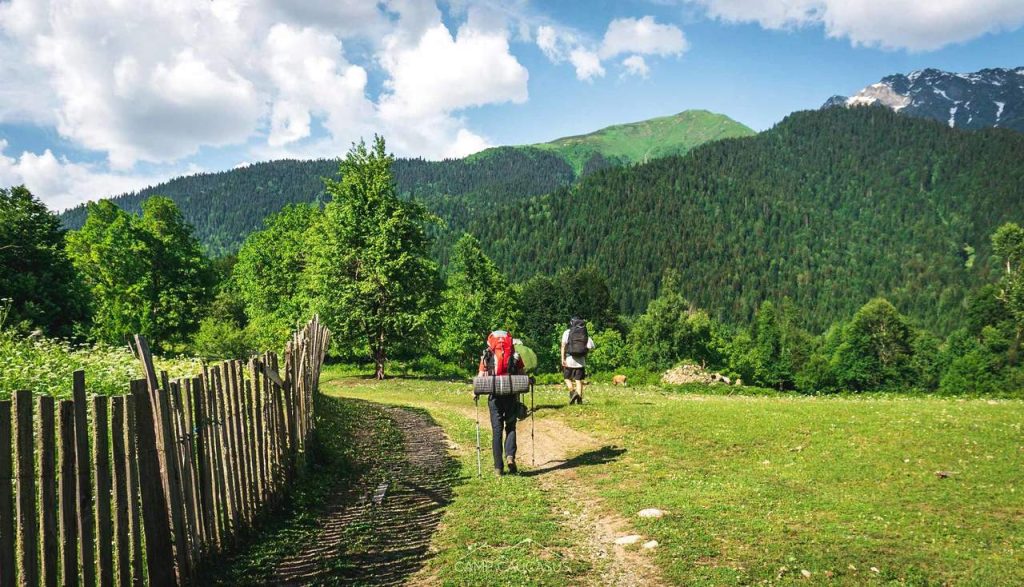
After majestic Utviri pass, you will have a less impressive trail that covers 2 major climbs and a number of small climbs going through the forests. You will pass by ruins on dirt roads as well as abandoned buildings, churches and small villages. You will have views of beautiful hills through open plains and big mountains and valleys until you reach the village of Kichkhuldashi.
Kichkhuldashi is a memorable place because it’s only one family living in the village. They completely supply themselves and the only products that they buy are sugar and flour. Valeri is a very charismatic man, and we advise you to pay him a visit at his guesthouse to hear a lot of interesting stories. After Kichkhuldashi, you’ll follow a forested trail, cross streams over bridges, and eventually ascend back to villages on your way to Pari, a small village with some guesthouses. Yet another 4 km will be left to Iskari (Etseri community) mostly on a dirt road with some forested parts.

In Iskari, you will find Tom’s guesthouse that offers all what hikers need, bed and shower, and a small shop with food and drinks. It was a very refreshing night for us. Due to coronavirus everything was closed in the village and they were very nice to ask neighbors to help us, prepare the rooms and let us in overnight. From Iskari you’ll continue on a dirt road, before steadily going up towards the 2462 m Baki Pass. The trail is mostly open here and takes you uphill gradually, becoming steeper only in the end. But you’ll surely be rewarded at the top of the pass and enjoy picturesque views above Mazeri.
For an hour you’ll be hiking on the ridge without losing the elevation. Soon you’ll get closer to the church and a lake, a nice place to have a short break or lunch. After it the trail will start to descend through the forest. It is steep in some parts, but zigzags help a lot. Eventually you’ll reach the dirt road that will take you to Mazeri.
Recommendation:
- Take a day hike to Shdugra waterfall
Do you like images? More from our adventures you can see on Instagram.
Section 3: Becho to Mestia
Distance: 21 km
Accumulated elevation Gain: ⬆ 1627m; ⬇ 1806m
Hiking time: 10 hours
This section is not an easy one. The first half of the route is a challenging 1.5 km climb up to Guli Pass (2,954 m) with stunning views of the twin peak of Mount Ushba (4,710 m), renowned for its beauty which has been nicknamed as the Matterhorn of the Caucasus. And the second part of the trail is going down through the mouth of the pass, passing by the Koruldi Lakes and descending all the way down into the city of Mestia. The trail starts on a dirt road, when you reach a bridge you must turn right before crossing it and continue hiking on the right side of the river. From there, the path will lead you to the ruins of Guli village, it’s quite easy to follow as there are red and white markings on rocks and trees.
From Guli village, you continue hiking up to the pass. The GPX track on your phone (for example, Maps.me app) will be very handy here. After some exhausting 3-4 hours you’ll reach the top of the pass. Guli Pass is a great spot for lunch if weather allows but we weren’t lucky, hail and thunderstorms didn’t leave us any options but to move faster. From the pass, it will take another 3-5 hours to hike down to Mestia. You need to walk on the right side from the signpost along the ridge. After a short time, you’ll see another signpost from where the steep path starts, it’s very slippery and dangerous in rain, so be careful.
This part of the trail can be quite tricky even in the good weather, with scree, rocks and snow-covered river crossings. It will take several hours to reach the place where you’re connected with Koruldi lake trail. After some time you’ll reach Mestia Cross with the beautiful view of the town and soon after it you’ll have an option to take a steeper but shorter trail through the forest, avoiding the dirt road. The path will take you directly to Mestia.
Recommendation:
- It’s best to get an early start as Mt Ushba tends to get covered by clouds around noon – also this hike can take up to 10 hours, however fast hikers will be able to do it in 7-8 hours.
- If you have time and equipment with you, we’d advise you to camp in the mouth of the Guli Pass, which is very beautiful and will make the rest of the downhill less traumatic for knee joints.
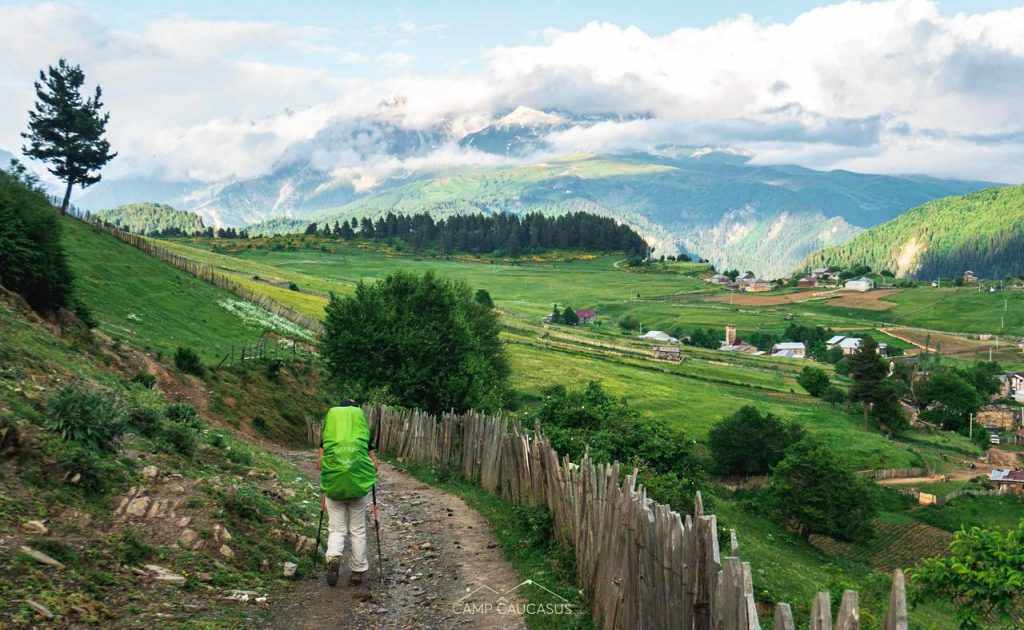
Section 4: Mestia to Adishi via Tsvirmi
This is the start of the almost traditional Mestia to Ushguli trek and you will start running into a higher number of trekkers at this point. Almost because we believe that the alternative route via Tsvrimi village is much more beautiful with better views. And village Tsvirmi itself is a beautifully located medieval settlement with authentic charm, off the main tourist tracks.
Day 1 Mestia –> Tsvirmi
Distance: 20 km
Accumulated elevation Gain: ⬆ 1484m; ⬇ 1020m
Hiking time: 7 hours
The beginning of the trail is well marked with red and white paint, and it takes you slowly without any steep parts through meadows and forests, rivers and ridges. The first part of the trek is just getting out of Mestia and up to Zuruldi ridge. The hike up there is long, steep and not terribly scenic. Normally you can take the chair-lift all the way up to the top of the ridge (lower station on the Mestia-Ushguli road, near Svaneti Museum). However if the cable car is not working, you might want a lift by car to the middle station – Hatsvali, or hike all the way up yourself.
Once you are at the top, follow a marked trail along Zuruldi Range from where you’ll be able to see Ushba, Tetnuldi and other peaks of the Great Caucasus on your left, and villages Ieli and Tsvirmi on your right below. After you reach the 2nd group of cellular retranslating antennae at Mentashi hill, take the left trail to descend gradually (the right path won’t take you to Tsvirmi) through the meadows.
Getting off of Mentashi hill is probably the steepest, most dangerous piece of “hiking” in the whole section. You are literally clingy to small trees and rocks to lower yourself off of this mountainside. After getting down, you get to walk through beautiful fields with wildflowers and then peacefully descend into the village of Tsvirmi.
Day 2: Tsvirmi –> Adishi
Distance: 17 km
Accumulated elevation Gain: ⬆ 1273m ⬇ 1055m
Hiking time: 5 hours
You do a considerable amount of walking on roads uphill and downhill this day. After a few hours, you’ll reach a point where your trail connects with the original one. A little further, you’ll see some ski lifts. There, you can take the upper or the lower trail. Both lead to Adishi. The upper option offers much better views. The lower trail is easier, but the views are less impressive too.
Section 5: Adishi to Ushguli via Iprali
Distance: 19 km
Accumulated elevation Gain: ⬆ 860m ⬇ 1091m
Hiking Time: 6 hours
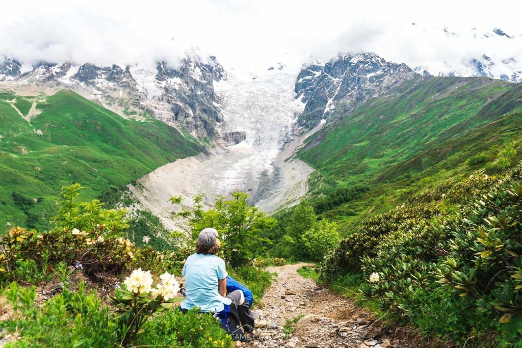
The river is the runoff of the Adishi glacier, so it is literally freezing cold. You have the option of hiring a horse to take you across the river or you can try to ford it barefoot.
After admiring the Adishi glacier, it is time to get moving up towards Chkhunderi Pass. The climb to the pass is one of the most beautiful parts of this section, which is 2,700 meters high and offers spectacular views of the Adishi Glacier.
After crossing the river you will be walking up little mini streams for the majority of this 2 hour ascent. From the ridge you descend into the secluded alpine valley of the Khadeshala river with colorful wildflowers. At the bottom of the valley, you can turn right and walk south-west to Khalde (4 km) or Iprali (6km). There you will find several guesthouses. This is a good option in heavy rain or if you do not carry a tent. I was happy to be heading downhill, although I did not realize that we still had about 2 more hours of hiking to do. Thankfully, once you are in the valley after the pass, it is mostly a flat trail to Iprali.
Recommendations:
- If you decide to cross the river by yourself then do it in the early morning when its level is much lower. Sandals might be handy to not make boots wet or slip barefoot on rocks.
Day 2: Iprali to Ushguli
Distance: 12.3 kilometers
Accumulated elevation Gain: ⬆ 930 m ⬇ 603 m
Hiking Time: 4 hours
It’s the last day of the TCT hike where in the end you will be rewarded with the highest permanently inhabited village in Europe and UNESCO World Heritage Site – Ushguli (2200 m). It is really important when you leave Iprali that you use a GPX map to find the trail to Ushguli. If you miss the trail, you will walk along a dusty, busy road the entire day. We were able to locate the upper trail, but it isn’t obvious and you almost feel as though you are trespassing on someone’s property – but this is indeed the trail. If you see any locals, you can ask them and they will gesture you in the right direction.
This upper route is much prettier than walking along a dirt road but the trail does need some maintenance – lots of branches and plants encroaching upon the path which was irritating at times. After a few hours you begin to descend to the main road and you start getting closer to Ushguli, but before reaching it, you will pass through other beautiful villages with remarkable medieval towers.
Recommendation:
- Take a day hike to shkhara glacier

How to leave Ushguli
Take a taxi to Mestia, from Mestia you can take Marshrutka to Zugdidi and then train to Tbilisi. Or direct Marshrutka to Tbilisi, but it will be a long and exhausting journey.
Where to stay in Svaneti by villages
- Kvemo Marghi – Guest House KIRARI
- Nakra – +995577146752 Nino (Valeri Vibliani’s daughter)
- Kichkhuldashi – +995577358972 Valeri Vibliani, only guesthouse in the village
- Iskari – Tony Hanmer Guest House & Shop
- Mazeri – Peak Mazeri Guest House
- Mestia – Guesthouse Ratison
- Tsvirmi – Shorena’s Guesthouse
- Adishi – Gunter’s Guesthouse
- Iprali – Ucha Margvelani Hotel, [email protected] (+995) 599 250578
- Ushguli – Hotel Tekla
Recent Articles
-

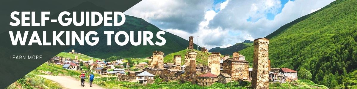
Self-guided Walking Tours – Everything You Need to Know
Self-guided walking tours weren’t a common solution to use for travelers till Covid-19 came into the game. But it wasn’t something new…
-
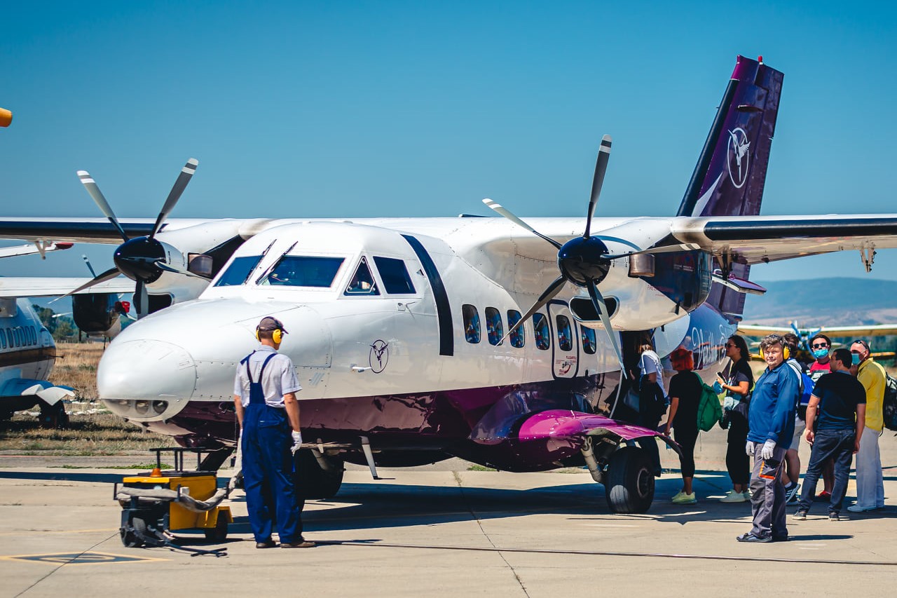
How to Travel to Mestia from Tbilisi, Kutaisi or Zugdidi in 2026
The detailed guide on how to get to Mestia from Tbilisi, Kutaisi, Zugdidi, or Batumi by Marshrutka, train, or plain. Plan trip to Svaneti!
-
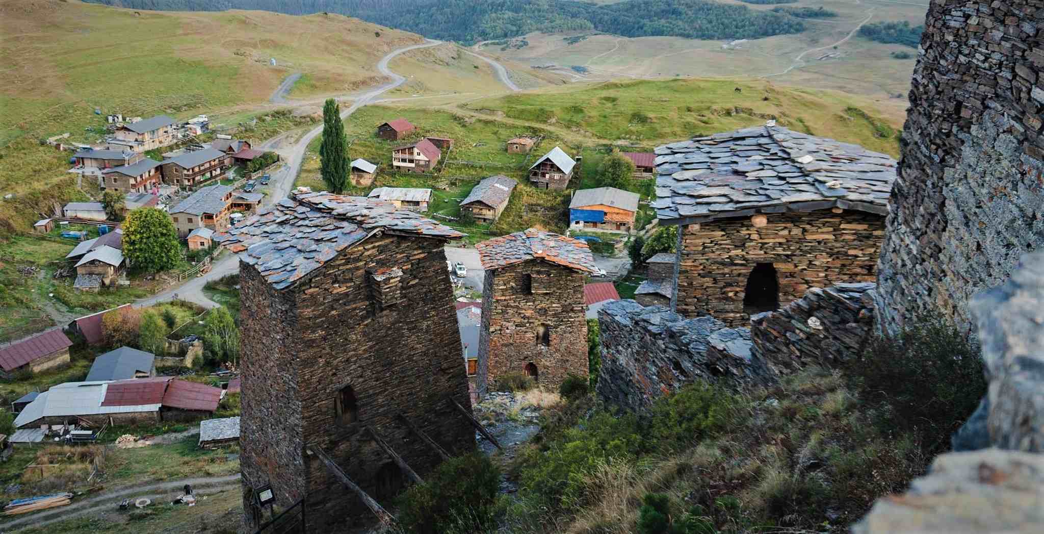
Tusheti National Park
Tusheti National Park is a huge National reserve on the East Caucasus Mountains. It is located in the structural basin of Tusheti,…


